Maya Expeditions' first trip to the Usumacinta
was in 1985. Since then, it has become one of our most requested
trips.
Now, Educational tours and presentations
will be given by our trip archaeologists to groups traveling
with Maya Expeditions. The only way to get to Piedras
Negras is by river, and Maya Expeditions will take you,
the same way we transported the first archaeological team
in 1995, by river, through the canyons of the Sierra Lacandon
Natural Reserve on the Usumacinta river. We can customize
the trip for groups with special interests, such as shamanism,
bird watching, architecture, astronomy, photography, et cetera.
Other Sites Visited on Piedras Negras Tours:
YAXCHILAN
This formidable defensive sight is located in the "island"
formed by the Usumacinta river bending in a horseshoe configuration.
It was rediscovered by following the Lacandon Indians who
made pilgrimages to its ritual center. Yaxchilan stelea date
from 450-800 ad. and show a great variety of format and subject
matter. According to Carolyn E. Tate, "The Maya...conceived
the imagery of each monument in relation to meanings woven
by symbols...it was clear that cultural ideals and community
identity were being forged through art. [Yaxchilan] itself
was the work of art, not one which was passively admired,
but one whose creation attracted ideal order into the lives
of its inhabitants"
PALENQUE
Located at the edge of the mountainous region of the Lacandon
Forest and the dry lowland of the Yucatan Peninsula, Palenque
formed an ideal location for trade. The site is noted for
the unusual hierarchy of two women rulers. The second longest
inscription in the Maya World is located at Palenque within
the first temple that is believed to have been built specifically
to house the deceased ruler, Pacal. All of this elaborate
ritual justified his right to rule, as he was a descendent
from a women ruler in the normal patriarchal system.
New Discoveries at Palenque - The current Palenque project
has unearthed an elaborate tomb with a painted mural in Temple
XX. The carved and painted throne, bearing an extensive hieroglyphic
text, was found in Temple XIX. Both of these structures are
located in the Cross Group complex. The ruler depicted on
the throne was King Akhal Mo'Nab III (also known as Chaacal
II), who ruled from AD 721-731. Temple XIX also yielded an
11 foot carved panel with a sculptured image of Akhal Mo'Nab
III, shown with a second royal personage who kneels behind
him and holds his hand.
TIKAL
The massive ruins of Tikal are concentrated at the center
of the Tikal National Park ( 222 square miles ). The park
is full of trails that lead to all the major archaeological
groups: the Great Plaza, Temple 1 (Temple of the great Jaguar
), Temples 2,3 and 4, The Lost World, and the Inscriptions
Temple. The richness of the forest in the area of Tikal ranges
from huge trees with heights of up to 150 feet to a great
variety of low and high ferns. Regarding bird watching, some
two hundred and eighty-five species of birds have been recorded
in Tikal. Please ask us about bird watching trips to Tikal,
the Petexbatun area and Rio Azul, offered by top guides working
on site at these natural and archaeological reserves.
THE GUATEMALAN
NATIONAL MUSEUM OF ANTHROPOLOGY
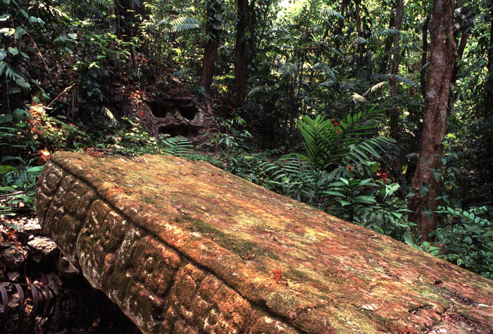
This building houses the stealea and famous throne design
found at Piedras Negras during the Pennsylvania excavations
of 1939. The tractor used to haul these immense carvings for
transport to the museum can still be seen in the jungles of
Piedras Negras. The museum also houses the recent discoveries
at Dos Pilas and the Petexbatun region. Various displays of
Maya life, blood letting and death ritulas give one a more
profound understanding of the cosmology of the Maya.
CEIBAL
Getting to Ceibal is half of the fun. To visit this site you
most first drive south from Flores to the Village of Sayaxche
(69 Km), then take a short boat ride on La Pasion River, and
then walk for about 45 minutes in the tropical rain forest.
The site itself is beautiful, and although the temples are
not as large as those in Tikal, the main stele is one of the
most well preserved from the Late Classic Maya period and
clearly bears signs of influence from the Toltec culture.
A round temple of the Mayan Culture brings up curious discussions
of its original use.
Aguateca
Located at the peninsula de Petexbatun, Aguateca faces the
lagoon of the same name. This site is only 1 hour away from
Sayaxche (by boat). The scenic boat ride will take you deep
into the jungle from the Rio La Pasion to the small waterways
of the Arroyo de Petexbatun. Twin city to Dos Pilas, Aguateca
was fortified on a plateau above lake Petexbatun as rulers
escalated warfare against neighboring city-states. Despite
the walls and natural defenses, this fortress proved vulnerable
and the settlement was overwhelmed sometime after 790, the
date recorded in stele # 2, the last dated stele. New excavations
from the Petexbatun Regional Project have discovered a mass
abandonment due to savage fire caused by warfare. In this
conflagration, many items used in the everyday life of the
ancient Maya people were preserved underneath the rubble.
Archaeologists are studying the daily life of the Maya and
the unique ritual ceremonies that are often depicted on the
steleas and ceramics found at most sites. Recent excvations
in 1999 have unearthed new steleas that place the site of
Aguateca under the reign of Tamarandito before Dos Pilas came
into power.
PUNTA DE CHIMINO
This small site is located on a peninsula jutted out into
the Lake Petexbatun. The motes dug out of the land connecting
the Peninsula and the evidence of an additional 45 foot wall
built as a stronghold give credence to the belief that there
was continual warfare during the late classic period. Recent
excavations suggest the influence or occupation of the not
so distant site of Ceibal.
PLANCHON
DE LAS FIGURAS
A long obscure Maya site, Planchon de las Figuras is only
visible during the low water months of March through early
June. It is a large rock beach where nearly 70 eroded carvings
depicting animals, humans, mysterious spirals and large temple
pyramids similar to those of Tikal can be found. These carvings
etched out of the stone have survived the centuries even though
they are covered by the waters of the Lacantun river for nearly
9 months out of the year. Perhaps they are the graffiti of
Maya traders who traveled this route between the Altar de
Sacrificios and Yaxchilan.
ALTAR
DE SACRIFICIOS
At the time of its exacavation, this site revealed extraordinary
burial scenes with various ceramic plates covering the heads
of the deceased in what seemed to be a form of ritual protection.
All have been removed or reburied. The site has been abandoned
and is now actually farmed. The stelea and altars we see are
of a unique sandstone unlike the limestone of other sites.
The last excavation left various open test digs, which enables
us to examine the typical "fill" style of the Maya
as many broken chards and obsidian flakes protrude from the
now rain eroded walls.
BONAMPAK
The murals of Bonampak are vibrant with the colors used by
the Maya in their art. There are three rooms which graphically
show scenes of celebration, battle, and sacrafice. The scenes
of pomp, warfare and intimacy helped Mayanist shape an image
of the true life the Maya elite led. There is now a road that
leads directly to the site which also aids the Lacandons indians
which live in the area.
Don't miss the exiting and educational tours through ancient
Maya civilizations that are currently being offered by Maya
Expeditions!
|